Service 03 · 3D modelling
3D modelling and terrain models
Drone images become digital representations of real sites – for viewing, measuring and planning.
From images to a model
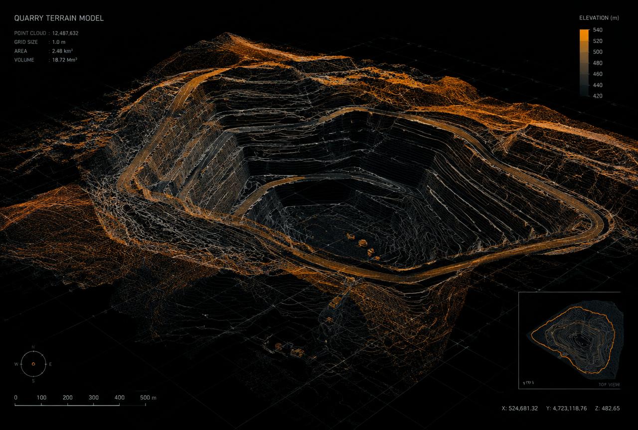
Photogrammetric processing combines drone images into a range of outputs, where project conditions allow. The most suitable deliverable depends on how the information will be used.
Possible deliverables
- Orthophoto – a scale-correct aerial image of the site
- Point cloud
- 3D model of the site or structure
- Terrain model / surface model
- Data for volume and area calculations
Why use a digital model?
A model makes it easier to understand a site, communicate with colleagues and clients, and make decisions without everyone needing to be on site. It also provides a record of conditions at a specific point in time.
Survey method and deliverable formats
We primarily survey using GNSS/RTK, which links the imagery directly to a coordinate system. Where needed, we add ground control points (GCPs) – for example when tighter positional control is required or site conditions call for it. The method is chosen based on the purpose of the project.
- Orthophotos and elevation models – GeoTIFF
- Point clouds – LAS/LAZ
- CAD data – DXF/DWG
- 3D model / mesh – OBJ
- Volume and summary reports – PDF
- Other formats and coordinate systems on request
Accuracy depends on factors such as flight altitude, image overlap, control points, terrain, vegetation, light and weather. We agree on realistic accuracy before the project starts.
Projects across Sweden and the Nordics
We take on assignments across Sweden and, by agreement, elsewhere in the Nordic region. Site size, travel, access and delivery requirements affect planning and pricing – tell us where and what, and we will come back with a proposal.
Frequently asked questions
How does 3D reconstruction work?
The object or area is photographed from many angles. Software matches common points between images and calculates a point cloud, which can then become a textured 3D model (mesh) or an elevation model.
Which file formats can be delivered?
Common formats are GeoTIFF, LAS/LAZ, OBJ, DXF/DWG and PDF, but we adapt to your systems.
How detailed will the model be?
Detail depends on flight altitude, camera, overlap and light. We agree on resolution based on how the model will be used.
More services
Volume calculation and material management
Volumes for stockpiles of crushed rock, gravel, sand, soil and other materials – for inventory control and monitoring.
02Quarry and land surveying
Drone mapping of rock and gravel quarries, work sites and land.
04Drone inspections
Visual checks and documentation of roofs, facades, industrial buildings and hard-to-reach areas.
05Documentation and repeat surveying
Repeat flights showing changes over time in stockpiles, quarries and work sites.
What do you need to survey or inspect?
Tell us about your site or structure and we will propose a suitable approach.